
Page 96 - JCAU-5-4
P. 96
Journal of Chinese
Architecture and Urbanism Cultural landscape in Huizhou City
cultural landscape factors. Third, the sample villages were
treated as “point elements,” and the geometric centers of
representative architectural clusters were chosen. These
center’s latitude and longitude coordinates were marked
and imported into ArcGIS for vectorization. Combined
with the Digital Elevation Model (DEM) data of Huizhou
City, the data collection and statistical analysis of relevant
cultural landscape factors were carried out. For the
descriptive cultural landscape factors, data were sourced
and collected through various means, including drone
and camera photography, mapping of relevant landscape
elements and drawings, and interviews with villagers.
These methods contribute to the archival and descriptive
statistical organization of the village data.
2.3.3. Dimensionality reduction of multiple indicators
using factor analysis
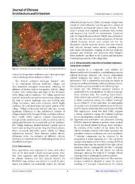
Figure 2. Distribution of research subjects. Source: Drawing by the authors Factor analysis is a commonly used method for
dimensionality reduction analysis, consolidating numerous
cultural landscape factor indicators and 5 descriptive-type cultural landscape elements into several independent
cultural landscape factor indicators (Table 1). cultural landscape key factors that reflect the main
The “natural ecological landscape features” refer information. This is achieved by exploring the matrix of
to the relationship between traditional villages and correlation coefficients between cultural landscape factors.
their peripheral ecological environment, reflecting the This calculation process unfolds in the following steps:
influence of factors such as topography, altitude, village (i) Model test: The SPSS26.0 statistical software is
location, river relationship, and slope on the formation employed for the test calculation of cultural landscape
of the village cultural landscape. The “village spatial form factor indicator data. The resulting Kaiser-Meyer-
features” include factors such as texture form, village area, Olkin (KMO) value is 0.623, exceeding 0.5, indicating
the ratio of natural landscape area and building area, a robust correlation among the cultural landscape
village orientation, and street structure, which highly factors (Table 2). At the same time, the approximate
condenses the settlement form and spatial pattern of the chi-square value of Bartlett’s sphericity test is 838.376,
village. “Village architectural features” take into account with 91 degrees of freedom and a significance of 0.000.
significant differences in the architectural features of This significance, much less than 0.001, suggests
villages influenced by Guangfu, Hakka, and Fukao cultures. a strong correlation among the cultural landscape
They vividly reflect regional cultural characteristics factors, making them suitable for factor analysis.
through architectural form, roof, wall, decoration, and the (ii) Eigenvalue and contribution rate calculation: Utilizing
relationship between the ancestral hall and the residence. SPSS26.0 statistical software to perform factor analysis
The “village landscape element features” include various on the data-based cultural landscape factor indicators,
factors such as feng shui ponds, feng shui forests, streets, the selection of the number of key factors for the
alleys, courtyards, and public spaces. Similar to “village cultural landscape is based on the initial eigenvalue and
architectural features,” these elements exhibit distinct cumulative variance contribution rate. Upon calculation,
differences under the influence of different cultures, 7 principal components can be extracted by the
serving as an important basis for delineating various zones requirement of initial eigenvalue λ≥1. The cumulative
of cultural landscapes. variance contribution rate is 70.56%, covering 70.56% of
the information from the original 18 data-type cultural
2.3.2. Data sources landscape factors. Consequently, the first 7 principal
Three approaches were employed to source and collect components serve as the key factors for cultural
data on the data-based cultural landscape factors. First, landscape, replacing the original 17 datatype cultural
data were organized and statistically analyzed based landscape factors in subsequent statistical analysis.
on relevant literature and field research. Second, the (iii) Cultural landscape key factor function: The maximum
BIGEMAP map software was utilized to search for place variance method is adopted to rotate the factors,
names and identify and statistically analyze the relevant resulting in 7 principal components as the cultural
Volume 5 Issue 4 (2023) 4 https://doi.org/10.36922/jcau.1311