
Page 84 - JCAU-6-3
P. 84
Journal of Chinese
Architecture and Urbanism Cultural landscape design and protection
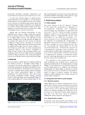
government leadership, enterprise participation, and data presented herein were sourced from Google Maps and
social involvement has been implemented (Hu et al., 2022). the authors’ fieldwork, employing a mobile phone for image
In recent years, with the support of national policies, capture and subsequent pictorial documentation.
Lifang Village has earned recognition as a model village for 3. Preliminary analysis
promoting national unity, a state-level traditional Yi cultural
reserve, a provincial-level characteristic tourism village, and 3.1. Policy analysis
a traditional Chinese village. In April 2017, it was designated The policy analysis of the 20 National Congress
th
as a “Chinese Minority Characteristic Village” by the State, of CPC report has emphasized the importance of
marking it as the first ethnic minority characteristic village “comprehensively promoting rural revitalization
in Shuangbai County to receive such an honor. and prioritizing the development of agriculture and
Aligned with the historical development of more rural areas.” The CPC Central Committee has placed
established ethnic minority villages, tourism has emerged significant emphasis on rural affairs and has formulated
as the most direct industry to mobilize villagers’ enthusiasm significant plans to comprehensively advance rural
by leveraging village resources. This approach not only revitalization. It has urged the acceleration of a
ensures a funding source for the protection of villages but robust agricultural sector establishment and outlined
also enhances the quality of life for residents and directly key objectives for promoting the modernization of
contributes to their economic well-being. As a traditional agriculture and rural areas in the new era. This guidance
Yi village, Lifang Village requires comprehensive protection provides a roadmap for rural revitalization in the new
of valuable physical space and folk culture (Huang et al., era. Concurrently, the official release of the 2023
2023; Wang et al., 2023; Wei et al., 2023). Simultaneously, Central Document No. 1 reiterated the imperative of
considering villagers as the primary contributors to “comprehensively promoting rural revitalization and
village life, their quality of life is intricately linked to the accelerating the modernization of agriculture and rural
development of the traditional village. Therefore, integrating areas.” It also reaffirmed that, within the broader goal
traditional village conservation with tourism development of “comprehensively building a modernized socialist
has become the optimal choice for advancing Lifang Village. country,” addressing challenges in rural areas stands as
the most critical and immediate task.
2. Methods
The establishment of the comprehensive strategy for
This study utilized a hybrid approach combining fieldwork rural revitalization has furnished policy support and
and literature research to investigate Lifang Village. It institutional frameworks for the transformation of Lifang
encompassed the systemic gathering and organization of Village, thereby establishing a solid policy foundation for
information pertaining to the village’s map, history, culture, practical implementation. In addition, the subsequent
and tourism development. Simultaneously, field visits were transformation of Lifang Village, as outlined in recently
conducted to examine private housing, collective buildings, issued policy documents, will benefit from comprehensive
and other typical representations related to tourism support in terms of financial, technical, and human
development and cultural landscape. These visits include resources, thereby facilitating the seamless execution of
documenting architectural features through drawings transformational initiatives.
(Figure 1), capturing village scenes in photographs (Figure 2),
and recording folklore and cultural activities (Figure 3). The 3.2. Geographic information system analysis
3.2.1. Elevation analysis
Lifang Village sits at an altitude of approximately 2,238 m
above sea level, characterized by an overall terrain trend of
low in the west and high in the east. The lowest point of the
terrain is around 2,157 m, while the highest reaches about
2,286 m. In subsequent designs, areas with flatter terrain
are chosen for constructing the ethnic culture experience
area, while areas with steeper terrain are selected for
building the outdoor experience area (Figure 4).
3.2.2. Slope direction analysis
As depicted in the slope direction map (Figure 5), the
Figure 1. Satellite map of the study site. Source: Google Maps central area of the site predominantly faces west, south,
Volume 6 Issue 3 (2024) 4 https://doi.org/10.36922/jcau.2891