
Page 37 - JCAU-6-3
P. 37
Journal of Chinese
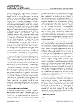
Architecture and Urbanism Multidimensional image of Guilin’s central space
identify Lijiang Road as a highly cognized road, whereas of Guilin’s urban central space, while commercial images
Zhongshan Middle Road overlaps between the traditional have, to some extent, contributed to the development of the
analysis and the big data analysis. However, the big data outer ring region of the urban central space. However, in
results reveal that people exhibit the highest awareness of general, the city’s construction lacks close integration with
East-West Lane. There is no unified path of high cognition the advantages of landscape. Furthermore, the distribution
identified by all three methods. The consistency in research of natural landscapes limits the development of urban
results likely stems from Lijiang Road being a primary traffic networks, resulting in a less comprehensible and
road connecting important public places, such as stations, less systematic urban central space in Guilin. Although
experiencing heavy traffic flows. However, people usually there is a noticeable development in tourism-oriented
pass through quickly, resulting in limited emotional cognitive images, it has not maximized the development
attachment to specific places, thus reducing the likelihood of other cognitive images in Guilin, nor integrated them
of sharing records and geotagging on social platforms. into an organic whole. Consequently, Guilin’s urban
Zhongshan Middle Road, constructed early, hosts central space exhibits less comprehensive development,
numerous recreational and commercial cognitive spaces with a high-awareness area demonstrating characteristics
along its route despite not having as strong connectivity of widespread dispersion and limited aggregation. People’s
to other areas as newer roads. People tend to traverse cognition of the area tends to be one-dimensional rather
this path slowly, increasing the likelihood of forming than multidimensional.
strong emotional preferences and cognitive memories
during multiple stays. The East-West Lane, a commercial In future planning and development of the urban central
pedestrian street that completely prohibits vehicle traffic, space of Guilin, emphasis should be placed on preserving
primarily serves recreational and entertainment purposes. and strengthening its natural landscape, historical culture,
People in this area are more likely to develop vivid cognitive and modern commerce images. Attention should be directed
memories. However, it suffers from weak publicity and is toward fostering connections between different types of
distant from the original urban public space, resulting in its images and improving the accessibility and convenience of
slow development. The demographic primarily cognizant road traffic. Leveraging the relevant research conclusion, it
of this area comprises young and middle-aged individuals. is crucial to improve or reshape the urban images to expand
the cognizable scope of Guilin’s urban central space, enhance
In general, the results of the traditional analysis and the its readability, and strengthen its urban characteristics. In
big data analysis are largely congruent, whereas the results addition, this study provides valuable insights for urban
of the spatial syntax analysis exhibit slightly less agreement development planning in other regions. It proves that cities
with the former two. This discrepancy likely arises from with rich hilly terrain or dense water network distributions
the spatial syntax methodology’s reliance on road network in their central urban areas should prioritize planning and
analysis, which encounters challenges in the presence of designing their traffic networks. It is suggested to employ
numerous old urban areas and natural landscapes within modern means, such as viaducts, underground passages, or
the urban central space of Guilin. While these areas have other advanced public transportation systems, to strengthen
garnered significant cognition throughout history, they connectivity between different functional blocks within the
also contribute to a fragmented urban spatial road network city. Implementing these measures will effectively increase
and relatively reduced road accessibility. The results of access frequency to distinct urban images and subsequently
spatial syntax cognition diverge from those of the other stimulate people’s cognitive memory.
two methods, leading to the dispersion of high-cognition
image locations. Consequently, the high-cognition area Grasping the cognitive imagery of the city can improve
presents characteristics of widespread dispersion and the assessment of its current urban space, providing deeper
limited aggregation. This disparity reflects the urban insights into the population’s living habits and spatial
pattern and image characteristics shaped by the prevalence preferences. This understanding is crucial for meeting
of hills and lakes throughout the urban central space of the evolving needs of the population in the later stages
Guilin. of planning. Urban planning, as the macro-control of
the entire city, plays a vital role in this process. Through
4. Discussion and conclusion scientific and meticulous planning, we can not only
In summary, this study used three methods – traditional develop the existing urban imagery elements, but also
analysis, spatial syntax analysis, and big data analysis – to create new urban imagery elements.
investigate the urban cognitive images of Guilin’s urban Acknowledgments
central space. The findings highlight the prevalence of
recreational images as the most prominent cognitive images None.
Volume 6 Issue 3 (2024) 13 https://doi.org/10.36922/jcau.1032