
Page 88 - AJWEP-22-5
P. 88
Fan, et al.
in Zhongwei City, flowing through the Weining and The terrain is uneven, with alluvial plains on both sides
Yinchuan Plains, and exiting the region at northern Ma of the Yellow River, characterized by relatively flat
Huang Gou in Shizuishan City. This area accounts for topography. The Yellow River flows through the region,
approximately 7.3% of the river’s total length. Based and the river valley is classified as an anticlinal fault
on a 40-year dataset (1956 – 1995), the average annual valley, forming the first-, second-, and third-level Yellow
runoff at the Lower Heyang Hydrological Station is River alluvial terraces. The first- and second-level
317 × 10 m³ per year, while the outgoing volume at alluvial terraces are scattered along both banks of the
8
the Shizuishan Hydrological Station is 294 × 10 m³ per Yellow River, with the main development areas located
8
year, resulting in an annual net water loss of 23 × 10 m³. south of Enhe, Wusha, and Changle. The geological
8
The average annual water consumption from the Yellow composition of these terraces primarily consists of silty
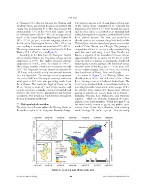
River is 32.0 × 10 m³ per year (Figure 1). sand, fine sand, and sandy gravel. Near Xuanhe and
8
According to the data from the Zhongwei County Baima, a segment of the second-level terrace extends
Meteorological Station, the long-term average annual approximately 40 km in length and 0.5 km in width,
temperature is 8.9°C. The highest recorded extreme while the first-level terrace is sporadically distributed,
temperature is 37.6°C, while the lowest is −29.2°C. featuring relatively flat surfaces. The third-level terrace
The average monthly temperature in summer exceeds stretches about 25 km long and 2 – 3 km wide, with
20°C. The long-term average annual precipitation is terrace heights ranging from 2 to 10 m, and is mainly
183.3 mm, with rainfall mainly concentrated between distributed south of Wusha, Enhe, and Changle.
July and September. The average annual evaporation As shown in Figure 2, the Weining Yellow river
rate reaches 1887 mm. The long-term average maximum alluvial plain is located on both sides of the Yellow
wind speed is 16.3 m/s, with prevailing winds from River, forming a narrow belt-shaped faulted basin. The
the northwest. The maximum depth of frozen soil is basin has accumulated thick, unconsolidated sediments,
83 cm. Spring is short, dry, and windy; summer and providing favorable conditions for water storage. Within
autumn experience relatively concentrated rainfall; and the alluvial plain, stratigraphic layers from different
winter is dry, with minimal precipitation and frequent geological periods are stacked from top to bottom –
sandstorms. The prevailing wind direction throughout including Miocene, Late Pleistocene, and Holocene
the year is from the northwest. 30 deposits – which are primarily composed of coarse-
grained, loose clastic materials. Within the upper 50 m,
2.2. Hydrogeological conditions the strata mainly consist of gravel and pebble layers
The study area is located within the Weining Basin, in derived from Yellow River alluvium, with relatively
the northern region of the Xiangshan Mountain Range. stable lithology. The surface layer (0 – 10 m) is mainly
Figure 1. Location map of the study area
Volume 22 Issue 5 (2025) 82 doi: 10.36922/AJWEP025260208