
Page 93 - EER-2-2
P. 93
Explora: Environment
and Resource Assessing ecosystems by land cover and landscapes
period from 2017 to 2023. Finally, we discuss the primary practices, such as overgrazing, irrational irrigation,
challenges associated with this approach for ecosystem insufficient reforestation, weak regulation of construction
accounting in Armenia. in natural areas, and the overuse of biological resources
(firewood, medicinal, edible, and ornamental plants)
2. Materials and methods by local populations. Most of the semi-desert zone is
2.1. Study area used for irrigated agriculture, which causes soil erosion,
secondary salinization, and desertification, contributing
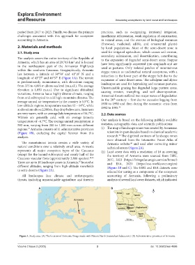
The analysis covers the entire territory of the Republic of to the expansion of degraded semi-desert areas. Steppes
Armenia, which has an area of 29,743 km and is located have been significantly converted into croplands and are
2
in the northeastern part of the Armenian Highlands used as pastures. Only isolated patches of mountainous
within the southern Caucasus. Geographically, Armenia steppe remain as undisturbed natural ecosystems, with a
lies between a latitude of 38°50’ and 41°18’ N and a reduction in the lower part of the steppe belt due to the
longitude of 43°27’ and 46°37’ E (Figure 1A). The terrain expansion of semi-desert areas. The subalpine and alpine
is predominantly mountainous, with elevations ranging landscapes are used for haymaking and summer pastures.
from 375 to 4,095 m above sea level (m.a.s.l.). The average Unsustainable grazing has degraded large pasture areas,
elevation is 1,850 m.a.s.l. Due to significant altitudinal causing erosion, trampling, and soil decomposition.
variations, Armenia has a highly diverse climate, ranging Armenia’s forests suffered two major waves of degradation
from arid subtropical to cold high-mountain climates. The in the 20 century – first due to excessive logging from
th
average annual air temperature in the country is 5.5°C. In 1930 to 1950 and then during the economic crisis from
low-altitude regions, temperature reaches 12 – 14°C, while 1992 to 1995. 36
at elevations above 2,500 m, they drop below zero. Summers
are very warm, with an average July temperature of 16.7°C. 2.2. Data sources
Winters are generally cold, with an average January
temperature of −6.7°C. The average annual precipitation is Our analysis is based on the following publicly available
592 mm, varying from 200 to 1,000 mm across different statistics, cartographic data, and scientific publications:
regions. Armenia consists of 11 administrative provinces (i) The map of landscape zones was created by Armenian
34
(Figure 1B), excluding the capital Yerevan from this scientists in past decades based on classical academic
36
analysis. research. The digitized contours of landscape zones
were obtained from the Interactive Forest Atlas of
The mountainous terrain creates a wide variety of Armenia website. and used after correcting minor
40
natural conditions over a relatively small area. Armenia technical errors (Figure 2A).
represents all major ecosystem types of the Caucasus (ii) Land cover data with a resolution of 10 m covering
(except for the humid subtropics) and nearly half of the the territory of Armenia were sourced from ESRI,
Caucasus vascular flora (approximately 3,800 species). 34,36 2017, 2023 (https://livingatlas.arcgis.com/en/home/)
There are up to 10 landscape zones in Armenia, located at and ESA, 2021 (https://esa-worldcover.org/en)
36
different altitudes, ranging from high-altitude snowfields (Figure 2B and C). The ESRI and ESA datasets were
to semi-deserts (Figure 2A). selected for testing as a component of the ecosystem
All landscapes face climate and anthropogenic accounting of Armenia, following a preliminary
threats, including unsustainable agriculture and forestry analysis of several land cover datasets, which indicated
A B
Figure 1. Study area. (A) The location of Armenia. Image made with Natural Earth (naturalearthdata.com). (B) Administrative provinces of Armenia.
Volume 2 Issue 2 (2025) 3 doi: 10.36922/eer.4996