
Page 61 - JCAU-5-3
P. 61
Journal of Chinese
Architecture and Urbanism Ecosystem service evaluation on ecological restoration
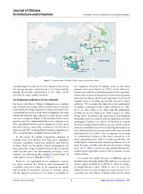
Figure 1. The geolocation of Shuiku Village. Source: Map by the authors
was discharged directly into the river. Based on the survey, the vegetation diversity of riparian zones in the water
the average nitrogen concentration is 1.41 mg/L and the network rural areas (Graf et al., 2019), which reflects the
average phosphorus concentration is 0.17 mg/L, which richness and stability of habitat provided by the vegetation
exceeded the water quality standards. community. In terms of regulatory services, existing studies
have explored the purification and regulation functions of
2.2. Evaluation indicators of river channels riparian zones in tackling agricultural non-point source
The study took Shuiku Village in Shanghai as an example pollution. This includes the deposition and purification
and surveyed 114 sample plots of seven types of riparian of surface runoff particulate matter (Zhang et al., 2007;
zones within the village. Based on the statistical results of the Yu et al., 2021; Zhao et al., 2022) and the purification
current land use types in rural areas in Shanghai, the study of water in the soil (Yang et al., 2019; Liang et al., 2022;
divided the land use types adjacent to rural riparian zones Wang, 2022). In addition, the regulation of microclimates
into seven categories (Figure 2): Residential area boundary in riparian zones as a typical scene in rural areas has been
riparian zone (R1), industrial land boundary riparian zone investigated (Garner et al., 2015). On the level of cultural
(R2), agricultural land boundary riparian zone (R3), pond services, existing research mainly focuses on the cultural
boundary riparian zone (R4), commercial land boundary services provided by rural rivers, including discussions on
riparian zone (R5), ecological land boundary riparian zone the cultural services of riparian zones in the water network
(R6), and green space boundary riparian zone (R7). rural areas (Liu et al., 2021). This encompasses showcasing
In this study, the spatial composition elements of the characteristic features of the water network in rural
riparian zones were divided into three parts: vegetation areas, supporting water-related recreational activities, and
structure, vegetation community hierarchy, and artificial exhibiting the historical and cultural significance of rural
facilities. Based on the results of field investigations, the areas through scientific and educational services (Wang
basic parameter range of spatial characteristics of current et al., 2021). Table 2 summarizes the spatial indicators for
rural riparian zones was summarized, providing a local evaluating the eight dimensions of the ecosystem services
reference for discussing the ecological performance of method above.
rural riparian zones in Shanghai (Table 1). To evaluate the supply efficiency of different types of
Based on the equivalent factor evaluation method, riparian zones, the study adopted the indicator of ecosystem
the study reviewed the literature and summarized the service supply-demand ratio (ESDR) to reflect the degree
evaluation indicators (Table 2) for assessing the supply of supply-demand match. ESDR is used to reflect the
and demand of ecosystem services in riparian zones. balance between the actual supply of ecosystem services in
On the support services level, the focus is primarily on a specific area and human demand, which can be either
Volume 5 Issue 3 (2023) 3 https://doi.org/10.36922/jcau.1055