
Page 127 - AJWEP-v22i3
P. 127
Groundwater trends in Karakalpakstan
in rainfall across the region, which is characterized by 26°C in the north, with recorded maximums as high as
infrequent precipitation events. In addition, snowfall 46°C. Annual precipitation averages 110 mm, with the
statistics were not included in the analysis, representing majority occurring during winter and spring. Droughts
a limitation that could be addressed in future research. are frequent, as evaporation rates are 9 – 10 times
greater than the average precipitation. The vegetation
2. Materials and methods period spans 194 – 214 days annually.
Karakalpakstan contains more than 21.3% of
2.1. Study area and data description Uzbekistan’s irrigated land and 48.5% of its pasturelands.
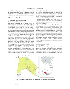
The Republic of Karakalpakstan is located in the Due to the arid climate, agriculture in the region is only
northwest of Uzbekistan (43°10’ N and 58°45’ E). viable through irrigation.
Administratively, it comprises 16 districts and one Groundwater data were obtained from the
central city, Nukus. Covering a total area of 166,600 km , Karakalpakstan Melioration Expedition, a governmental
2
Karakalpakstan accounts for 37.1% of the country’s agency. Monthly groundwater measurements were
total land area (Figure 1). The study area lies within collected over a 33-year period, from 1990 to 2023. For
the Aral Sea basin and shares borders with Kazakhstan this study, a total of 16 observation sites were selected
to the north and west, the Karakum sand massifs of for comprehensive groundwater analysis. These include
Turkmenistan to the south – along the modern and sites from the Southern Melioration system, Amudarya
ancient Amudarya delta – and the Qizilqum desert to the Amelioration system, Left-bank Melioration system, and
east. The territory of the Republic of Karakalpakstan is Right-bank Melioration system. The specific locations
characterized by relatively simple surface topography, are: Turtkul, Ellikkala, Beruniy, Amudarya, Khojeli,
with the Ustyurt Plateau occupying the western part Takhiatash, Shumanay, Kanlikul, Kungirot, Muynak,
and the Turan Plain covering the remainder. Elevations Nukus, Kegeyli, Buzatau, Chimbay, Karauzyak, and
range from 49 m below sea level in the southwest to Takhtakopir.
466 m above sea level in the northwest. The Republic
of Karakalpakstan has a harsh continental climate 2.2. Trend analysis models
characterized by arid summers, relatively cold winters, 2.2.1. MK model
and low annual precipitation, primarily in the form The MK model is a widely recognized non-parametric
of snow. Average January temperatures range from method for detecting monotonic trends in time series
−4.9°C in the southern region to −7.6°C in the northern data. Its popularity stems from its robustness against
region, with absolute minimums reaching −40°C. In non-normal data distributions and its ability to
July, average temperatures rise to 30°C in the south and accommodate missing values, making it an ideal choice
Figure 1. Location of study area in the Republic of Karakalpakstan, Uzbekistan
Volume 22 Issue 3 (2025) 121 doi: 10.36922/AJWEP025080052