
Page 173 - AJWEP-v22i3
P. 173
Maghnia wastewater and risk assessment
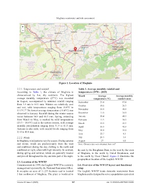
Figure 1. Location of Maghnia
2.2.1. Temperature and rainfall Table 1. Average monthly rainfall and
According to Table 1, the climate of Maghnia is temperature (1970 – 2019)
characterized by hot, dry summers. The highest Month Average Average monthly
average monthly temperature (27°C) was recorded temperature (°C) rainfall (mm)
in August, accompanied by minimal rainfall ranging September 23.4 15.4
from 3.4 nm to 6.01 mm. Winters are relatively cool October 19.6 26.3
and wet, with temperatures ranging from 10.4°C to
13.5°C. The lowest average temperature (10.4°C) was November 14.6 40.8
40
observed in January. Rainfall during the winter season December 11.6 34.9
varies between 34.9 and 40.5 mm. Spring, extending January 10.4 40.5
from March to May, is marked by mild temperatures February 11.3 38.2
(13.5 – 18.8°C) and is the wettest season, with average March 13.5 41.3
monthly precipitation ranging from 31.9 to 41.5 mm. April 15.5 41.5
Autumn is also mild, with rainfall levels ranging from May 18.8 31.9
15.4 to 40.8 mm.
June 22.7 8.3
2.2.2. Winds July 26.3 3.4
In Maghnia, wind patterns vary by season. During autumn August 27 6.0
and winter, winds are predominantly from the west Note: Climatic data were obtained from ref. 41
and southwest during the day, shifting to the north and
southwest at night, often with high intensity. In contrast, the east by the Boughrara Dam, to the west by the town
during spring and summer, winds are generally weaker of Maghnia, to the north by Ouled Bendamou, and
and prevail throughout the day and into part of the night. to the south by Oued Charef. Figure 2 illustrates the
geographical location of the Lagfafe WWTP.
2.3. Location of the WWTP
Commissioned in 1999, the Lagfafe WWTP is currently 2.4. Overview of the WWTP layout and functional
managed and operated by the National Sanitation Office. setup
It occupies an area of 11.233 hectares and is located The Lagfafe WWTP treats domestic wastewater from
5 km northwest of Maghnia. The plant is bordered to Maghnia and is designed to serve a population equivalent
Volume 22 Issue 3 (2025) 167 doi: 10.36922/AJWEP025120085