
Page 27 - JCAU-7-1
P. 27
Journal of Chinese
Architecture and Urbanism Spatial syntax of temple heritage
integration and the Y-axis representing local integration. decrease in the integration degree, especially in the village’s
The R value, which represents comprehensibility, ranges edge areas, where integration is at its lowest. The average
2
from 0 to 1. The red dot in the upper right corner represents global integration degree of Ganzi Temple settlement is
the axis with the highest comprehensibility, while the 1.34, with axes exceeding this value accounting for 0.52%
blue dot in the lower left corner represents the axis with of the total. This suggests that the overall integration degree
relatively lower comprehensibility. of the Ganzi Temple settlement is moderate, with generally
For the Baiyu Temple settlement, the correlation between good accessibility. Ganzi Temple settlement is located near
global and local integration is moderate, as indicated by Ganzi town, benefitting from strong external connections
the fitting coefficient. The comprehensibility value of 0.58 and good transportation accessibility. The main public
places the settlement in the “average” category, indicating buildings are located in the central area, where integration
that the street and alley system in the Baiyu Temple is highest.
settlement has an average level of comprehensibility. 4.2.3. Comprehensibility
4.2. Ganzi temple As shown in Figure 12, the comprehensibility value of
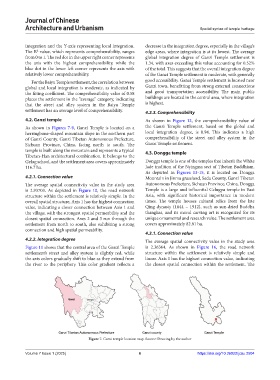
As shown in Figures 7-9, Ganzi Temple is located on a the Ganzi Temple settlement, based on the global and
herringbone-shaped mountain slope in the northern part local integration degree, is 0.94. This indicates a high
of Ganzi County, Ganzi Tibetan Autonomous Prefecture, comprehensibility of the street and alley system in the
Sichuan Province, China, facing north to south. The Ganzi Temple settlement.
temple is built along the mountain and represents a typical 4.3. Dongga temple
Tibetan-Han architectural combination. It belongs to the
Gelug school, and the settlement area covers approximately Dongga temple is one of the temples that inherit the White
116.7 ha. Jade tradition of the Nyingma sect of Tibetan Buddhism.
As depicted in Figures 13-15, it is located on Dongga
4.2.1. Connection value Mountain in Jinma grassland, Seda County, Ganzi Tibetan
The average spatial connectivity value in the study area Autonomous Prefecture, Sichuan Province, China. Dongga
is 2.93703. As depicted in Figure 10, the road network Temple is a large and influential Gelugpa temple in East
structure within the settlement is relatively simple. In the Asia, with significant historical importance in modern
overall spatial structure, Axis 1 has the highest connection times. The temple houses cultural relics from the late
value, indicating a closer connection between Axis 1 and Qing dynasty (1644 – 1912), such as sun-dried Buddha
the village, with the strongest spatial permeability and the thangkas, and its mural carving art is recognized for its
closest spatial connection. Axes 2 and 3 run through the unique ornamental and research value. The settlement area
settlement from north to south, also exhibiting a strong covers approximately 82.81 ha.
connection and high spatial permeability.
4.3.1. Connection value
4.2.2. Integration degree The average spatial connectivity value in the study area
Figure 11 shows that the central area of the Ganzi Temple is 2.36364. As shown in Figure 16, the road network
settlement’s street and alley system is slightly red, while structure within the settlement is relatively simple and
the axis colors gradually shift to blue as they extend from linear. Axis 1 has the highest connection value, indicating
the river to the periphery. This color gradient reflects a the closest spatial connection within the settlement. The
Figure 7. Ganzi temple location map. Source: Drawing by the author
Volume 7 Issue 1 (2025) 6 https://doi.org/10.36922/jcau.2504