
Page 31 - JCAU-7-1
P. 31
Journal of Chinese
Architecture and Urbanism Spatial syntax of temple heritage
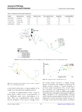
Table 1. Parameters of the temple settlements
Temple Settlement type Area (ha) Number of axes The connection value Integration Comprehensibility
Baiyu temple Temple-city 154.44 77 2.46753 0.58 0.58
Ganzi temple Temple-town 135.24 29 2.93103 1.34 0.94
Dongga temple Temple-village 130.26 22 2.36364 0.57 0.38
Gesang temple Temple 3.233 3 1.33333 0.21 -
Figure 16. Dongga settlement connection value and settlement status superposition map. Source: Drawing by the author
Figure 18. Dongga settlement comprehensibility map
and Gesang Temple settlements is limited. Foreign
Figure 17. Dongga settlement integration map. The number 1 represents
Axes 1. Source: Drawing by the author tourists, in particular, may struggle to comprehend the
village’s structure, leading to a weaker perception of
a result, local residents have a strong recognition of the its overall spatial characteristics. This, in turn, affects
temple, and it frequently hosts community activities. their impression and understanding of the village’s
overall space (Qi et al., 2020). In addition, the irregular
2
According to comprehensibility values, a lower R connection forms and angles of internal roads within the
fitting degree indicates poorer comprehensibility of village contribute to low comprehensibility, impeding
the settlement’s spatial system (Mairufujiang et al., tourists’ intuitive understanding of the spatial layout. The
2023). These low comprehensibility values indicate settlement’s extended construction timeline has also led
that the perception of local space in Dongga Temple to damage in some street and alley systems, resulting in
Volume 7 Issue 1 (2025) 10 https://doi.org/10.36922/jcau.2504