
Page 160 - JCAU-7-2
P. 160
Journal of Chinese
Architecture and Urbanism Tracing Minyue Kingdom’s roads with LCP
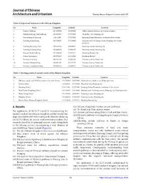
Table 4. Important fortresses in the Minyue Kingdom
No. Name Longitude Latitude Location
1. Fuzhou Yecheng 119.292904 26.095606 Gulou district, Fuzhou city, Fujian province
2. Wuyishancheng Cunhancheng 118.045281 27.555698 Wuyishan city, Nanping city
3. Datancheng of Jianyang 118.11386 27.327846 Jianyang Datan Mountain, southeast of the stream
4. Pucheng Linpucheng 118.526995 27.919668 Shuinan road, Pucheng county, Nanping city, Fujian
province
5. Pucheng Hanyang Chen 118.531596 28.068851 Pucheng county, Nanping city
6. Pucheng Linjiangcheng 118.466624 27.806233 Pucheng county, Nanping city
7. Shaowu Wushancheng 117.513624 27.337211 Nanping Shaowu city
8. Putian Yuewangtai 118.991063 25.612922 HanJiang district
9. Xianyou Jizicheng 118.731129 25.392553 Xianyou county, Putian city
10. Xianyou Shewancheng 118.807183 25.517773 Xianyou county, Putian city
11. Xianyou Longchuancheng 118.813416 25.688141 Xianyou county, Putian city
Table 5. Starting points of ancient roads of the Minyue Kingdom
No. Name Longitude Latitude Location
1. (Minyue capital city) Xindian ancient city ruins (from) 119.292904 26.095606 Gulou district, Fuzhou city, Fujian province
2. Jian’ou (from) 118.045281 27.555698 Wuyishan city, Nanping city
3. Nanping (from) 118.11386 27.327846 Jianyang Datan Mountain, southeast of the stream
4. West Fujian Yongding (from) 118.526995 27.919668 Shuinan road, Pucheng county, Nanping city, Fujian province
5. Shun Chang (from) 118.531596 28.068851 Pucheng county, Nanping city
6. Ninghua (from) 118.466624 27.806233 Pucheng county, Nanping city
7. Mount Wuyi, Minyue Kingdom (from) 117.513624 27.337211 Nanping Shaowu city
4. Results (ix) Minyue Kingdom’s riverine ancient pathways,
(x) Yu Shan’s anti-Han military routes,
The application of the LCP model in reconstructing the (xi) Ancient pathways along Futun Creek and Jian Creek,
ancient roads of the Minyue Kingdom yielded results that (xii) Minyue’s pathway to Guangchang in Jiangxi province,
align remarkably with historical records, thereby validating China,
the LCP’s efficacy in ancient road restoration studies. Our (xiii) Chanting ancient pathway to Ruijin in Jiangxi
research identified 13 principal ancient roads dating back province, China.
to the Minyue period, encompassing a total distance of
over 10,000 km. These include (Figure 6): These extensive networks of land and water
(i) Pre-Qin Minyue Kingdom’s riverine ancient pathways, transportation routes not only facilitated socio-cultural
(ii) Han army’s route of attack against the Minyue exchanges within Fujian, Zhejiang, Jiangxi, and Guangdong
Kingdom, provinces in China but also played a critical role during
(iii) Minyue’s ancient pathway to Jianhua (now Ningdu) in military confrontations with the Han rulers. The ancient
Jiangxi province, China, road network established during the Minyue Kingdom era
(iv) Minyue’s route for military expeditions toward is pivotal, as it forms the genesis of the modern provincial
Nanyue, traffic framework. Consequently, understanding these
(v) Branch route of Minyue’s military expedition toward ancient pathways is instrumental for contemporary inter-
Dongou, provincial tourism planning in Fujian, offering invaluable
(vi) Minyue’s military expedition route toward Dongou, insights into the region’s historical transportation
(vii) Branch route of Minyue’s pathway to Poyang Lake in dynamics.
Jiangxi province, China, The application of the LCP model, underpinned by
(viii) Minyue’s pathway to Poyang Lake in Jiangxi province, high-resolution DEM and Landsat 8 imagery, has yielded
China, precise reconstructions of the ancient road networks of
Volume 7 Issue 2 (2025) 10 https://doi.org/10.36922/jcau.4226